
Berkeley Earth’s new platform connects historical weather observations with bias-corrected climate model projections — for more than 8,000 cities and every country on Earth.

A single, connected picture of climate change
Berkeley Earth is pleased to announce the launch of Synthesis, a new platform that connects historical weather observations with bias-corrected climate model projections at a local scale. Synthesis is a major undertaking to unlock the value in both historical weather data and climate model projections, offering a robust, local, and easy-to-use platform for the diverse stakeholders planning to adapt and respond to global warming.
At its heart, Synthesis summarizes all the weather station data in Berkeley Earth’s archives together with the climate model projections in the CMIP6 archive to build something new: a downscaled, bias-corrected, local history that connects observed and future climate change.
“A downscaled, bias-corrected, local history connecting observed and future climate change.”
Open to everyone
Synthesis provides a new way to access Berkeley Earth data and connect it with the information needed for planning and decision-making. The platform is already open to everyone and currently requires a free registration.
Explore 8,000+ cities and 40,000+ stations
Past the login screen, you’ll find a map of cities offering localized history and projection data — a broad selection of over 8,000 global cities, plus regional averages for every country. Toggle over to direct access to historical weather-station temperature data across more than 40,000 sites.
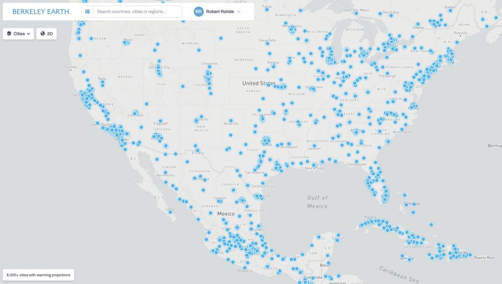
Toggle over to direct access to historical weather-station temperature data across more than 40,000 sites.
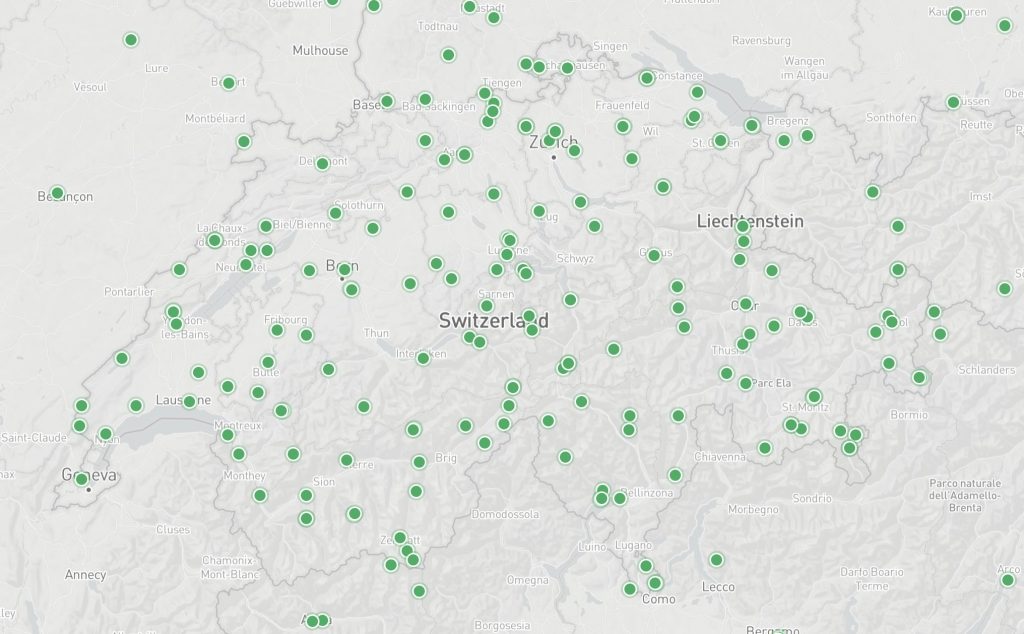
The search box helps you find cities, regions, and stations directly. Loading a region — like California — gives both historical data and future projections. The policy-aligned SSP2-4.5 scenario is the default, with up to five scenarios to choose from.

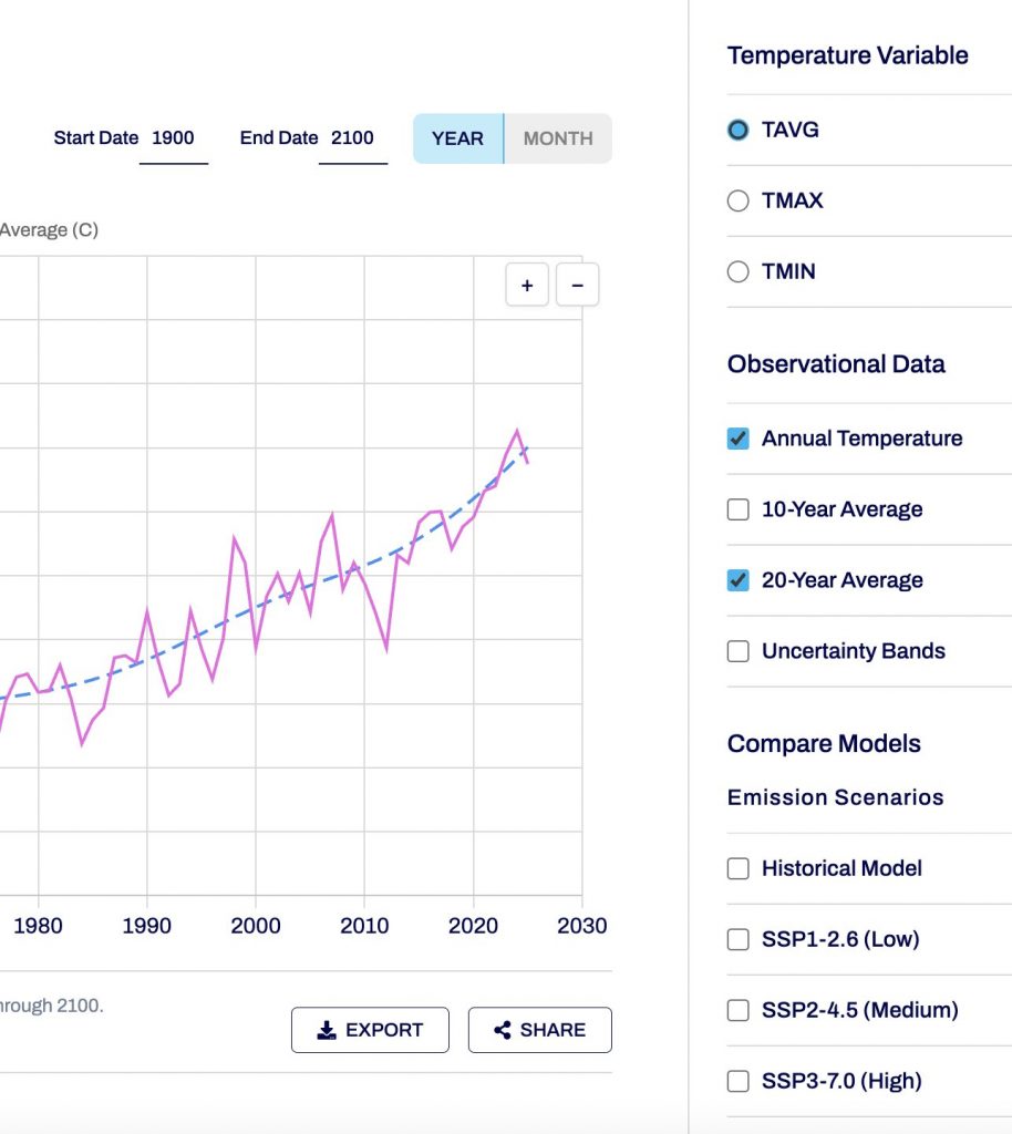
Toggles switch between monthly and annual series, and between average, maximum, and minimum temperature changes, in Fahrenheit or Celsius.
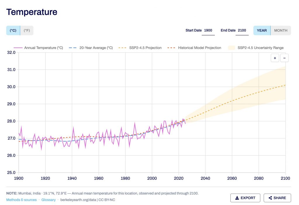
Similar charts are available for thousands of cities — for example, the annual average temperature for Mumbai, India. Large cities across the Global South are well represented.
Any city or region view, and the data within it, can be exported with a single click. Bulk data and commercial use can be requested separately at this google form.
Rigorous, bias-corrected projections
The projections in Synthesis are a unique bias-corrected synthesis spanning the CMIP6 climate model archive — roughly 45 models. Historical observations are used to bias-correct and select reliable models for each region, ensuring consistency from past to future. A more in-depth review of the science behind our climate model synthesis approach to bias-correction and downscaling is available here.
Beyond temperature: derived metrics
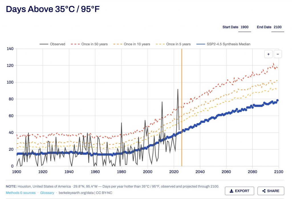
For selected cities, Synthesis provides daily derived metrics — such as the number of days above 35 °C / 95 °F (shown here for Houston, TX). Comparing models and observations in a consistent way helps reveal model reliability.
Synthesis also provides Cooling Degree Days, an estimate of demand for artificial cooling. In Paris, France, projected cooling demand has doubled over the last 40 years and is expected to redouble this century under current warming trends. Around 100 cities currently feature these expanded metrics, with additional cities, metrics, and ways of working with the data to be added over time.

Already in use — and just getting started
The data has already supported a partnership with C40 Cities on a global study of projected changes in cooling demand as the world warms, with more findings to be shared soon. The goal of Synthesis is to connect past and future climate change at a local scale, in a way that serves the general public and helps stakeholders such as policymakers, builders, and farmers prepare through adaptation and resilience.
Synthesis historical data will be updated monthly alongside other Berkeley Earth datasets, and its features, cities, and options will continue to expand over time.
Start exploring your city’s climate future.
Free registration · 8,000+ cities · every country
Synthesis Overview
For more information about the science behind Synthesis, as well as how Synthesis data powered C40 Cities’ cooling-demand study, see the Synthesis overview (PDF).